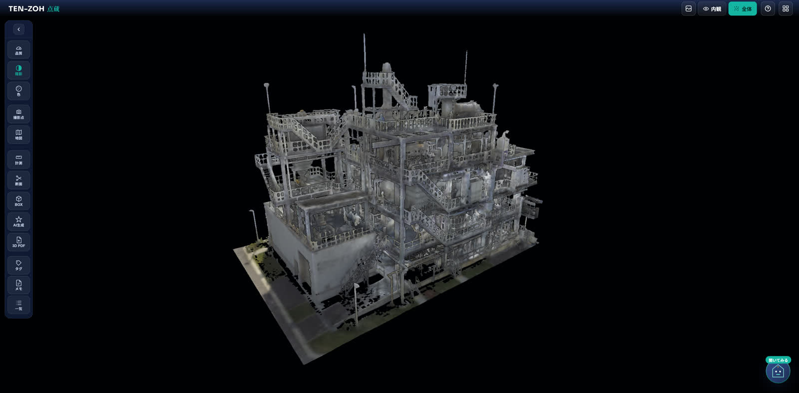

TENZOH viewer showing the point cloud of a multi-story wastewater treatment plant building

Point cloud sharing platform

Large point clouds,
shared securely,
in the browser.

TENZOH, our point cloud viewer, lets you share 3D scan data from the field through a single URL. Nothing to install. It stays quick even on a phone.

Early testers wanted Nothing to install Works on phones, tablets, and computers

We exhibited at the Sewage Works Exhibition '26 Tokyo, in a joint booth with SUZUTECH.

TENZOH by Recmill Inc.

Six Pillars

TENZOH: every point, kept safe.

The name comes from an old Japanese idea: what matters goes into the storehouse, kept safe and passed on. Here are the six pillars of TENZOH.

01 Every point, kept safe

We store large point cloud data encrypted at rest. Permissions and share links give you fine-grained control over who sees what, so the site data you care about stays protected.

02 Quick on a phone

Even point clouds with hundreds of millions of points render smoothly in the browser alone. Open them straight from a phone or tablet in the field.

03 Simple to use, fully featured

Measurement, cross sections, box selection, and display modes. The tools of specialist software, with controls anyone can pick up.

04 Linked to the map

The point cloud sits on its real-world coordinates, overlaid on a map. One look tells you which site the data covers.

05 Leave tags and notes

Mark the spots you care about, leave a record, and share it. Inspection, handover, and reporting stay on the 3D data from start to finish.

06 AI-generated 3D objects

“We want to put a pump here.” From words like these, TENZOH creates a full-scale 3D object you can place in the point cloud to check the fit.

Features

See the screens.

Every image here is an actual viewer screen. Even large datasets handle like this, in the browser alone.

View

Move through large point clouds in the browser

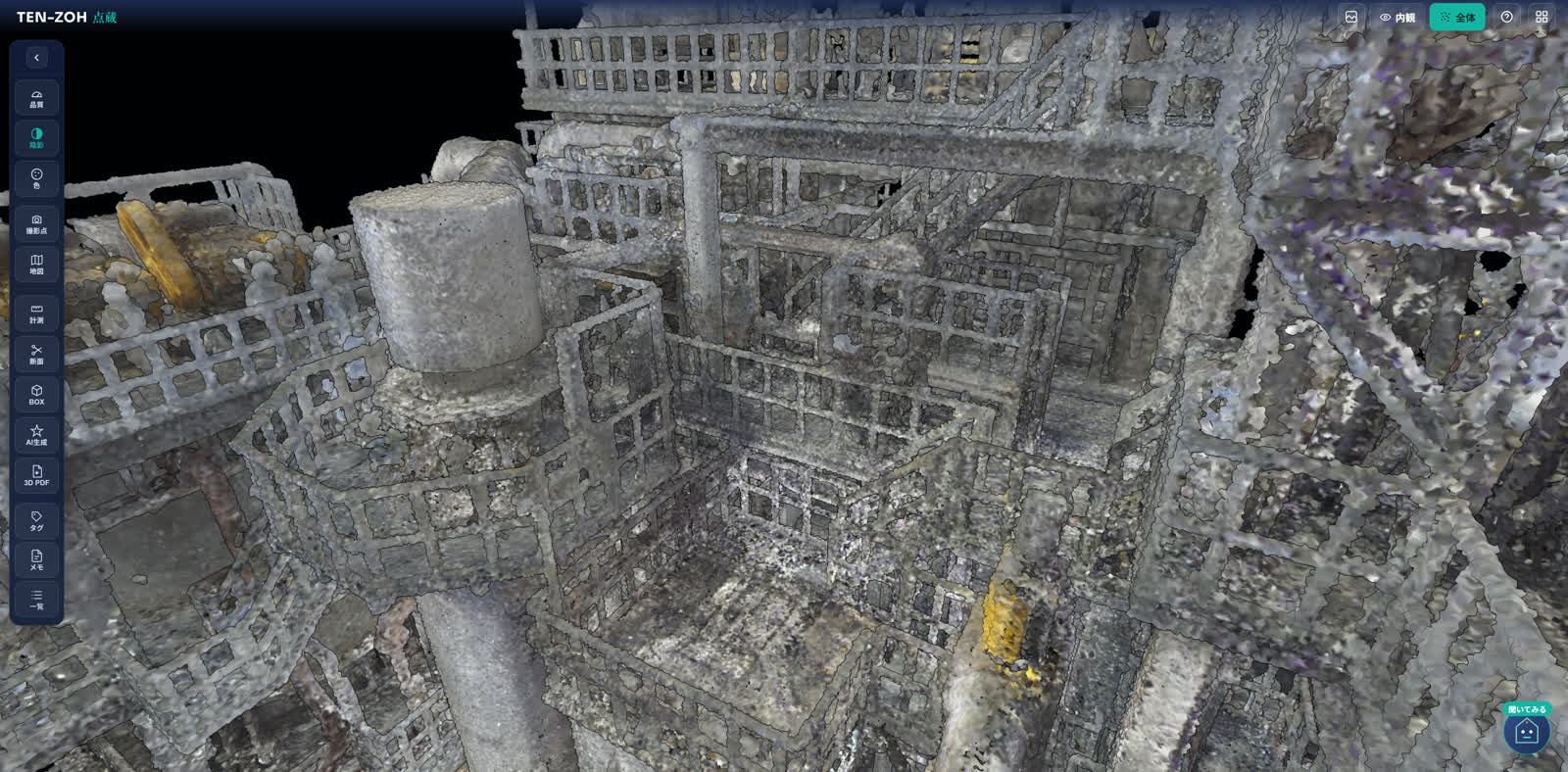
Fly-through, rotation, and zoom stay smooth. Display quality adjusts automatically, so viewing stays comfortable even on a mobile connection in the field.
  • Nothing to install—just open a URL
  • Issue and revoke share links easily
Moving through the point cloud of a plant interior in TENZOH, with the tool sidebar on the left
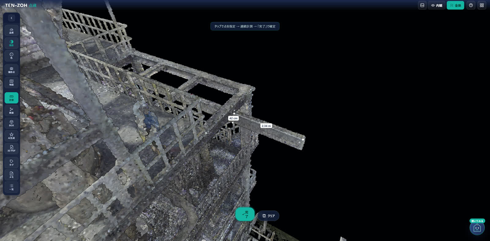
Measuring in TENZOH, with distances of 42 cm and 2.34 m shown on a plant structure in the point cloud
Measure

Measure and cut cross sections on the spot

Measuring a distance takes a few clicks. You can also measure accurately along a chosen axis, or cut a cross section to look inside—all without specialist software.

  • Point-to-point distance, continuous distance, and measurement along an axis
  • Check internal structure with a section box
Annotate

Add tags and notes right on the point cloud

Drop a tag or a note on the spot you care about, and attach photos and files. Send the link, and the other person opens the same spot from the same viewpoint.
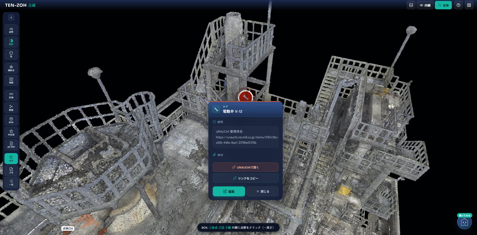
  • Status tracking (not started, in progress, and done)
  • Share a direct link to the exact spot
Tags and notes screen
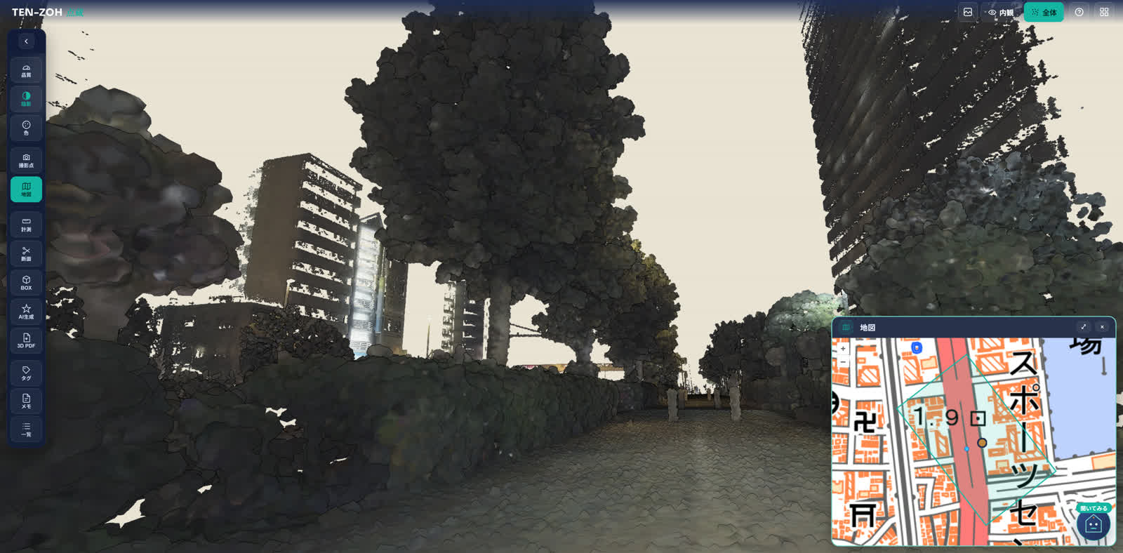
Street-level view inside the point cloud with the map panel open, showing where the data was captured
Map

See where the point cloud sits on the map

Data with location information is linked to the map. When you have data from multiple sites, you can pick one on the map and open it.

AI

From words to full-scale 3D

“Can a control panel fit next to this pipe?” AI generates a 3D object at its actual catalog dimensions and places it in the point cloud. You can work through a retrofit or an expansion on the spot.

Patent pending
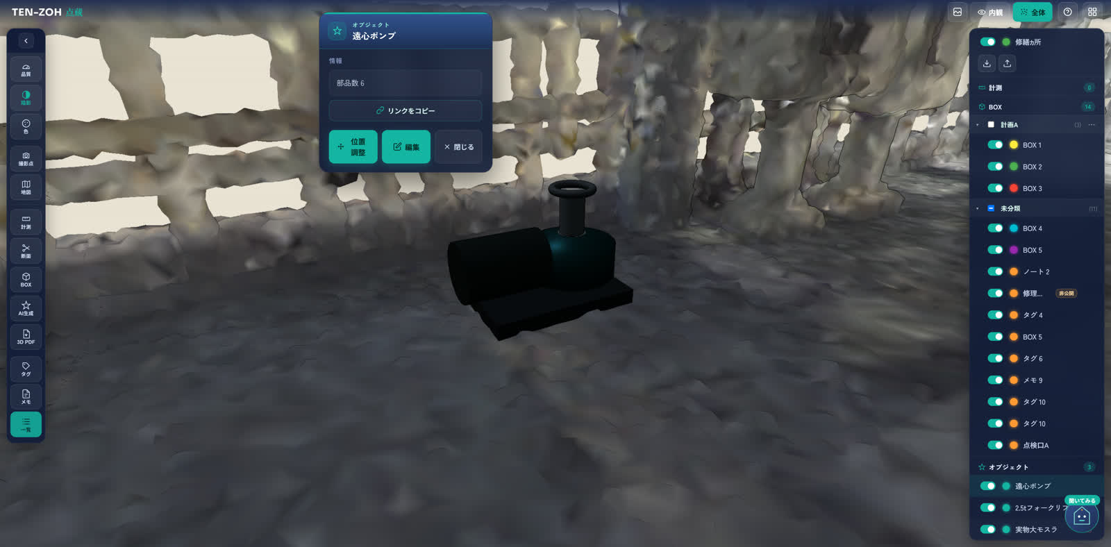
An AI-generated 3D model of a centrifugal pump placed inside the point cloud, with the object list on the right

Security

Built like a vault.

Your 3D site data is a valuable asset. We build security into TENZOH from the design stage, and we keep running third-party security assessments and improving on what they find.

Encryption

Data is encrypted in transit and at rest, and is hosted in Japan.

Access control

You control permissions at the organization, project, and dataset level. On a public link, you can set an expiration date, add a password, and revoke access at any time.

Activity log

We log who viewed or acted on what, and when. You can also see how the people you shared with are using it.

Ongoing security assessments

We repeat security assessments from an attacker's point of view, and what we find keeps going back into the product.

Read the full security overview

Movie

TENZOH in one minute.

Coming Soon

Pairs with URAUCHI.

We are building a link between TENZOH and URAUCHI, our knowledge platform for field decisions, so you can move between the 3D space and the equipment information tied to it. From an equipment tag in the point cloud, open the equipment record. From “See its position in 3D” in the record, jump back into the point cloud. Space in TENZOH, knowledge in URAUCHI: that is how information from your site connects.

In development
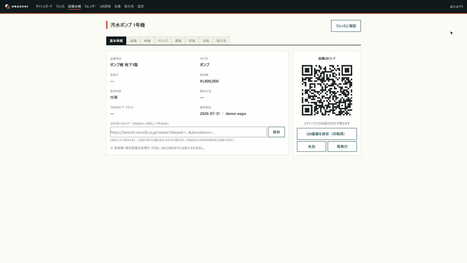
URAUCHI equipment record for a pump, showing its location, category, QR code, and a link into the 3D point cloud

FAQ

Frequently asked questions

Do I need to install anything?
No. Nothing to install—just open a URL in your browser. It works on phones, tablets, and computers. Even point clouds with hundreds of millions of points render smoothly in the browser alone, with display quality adjusting automatically.
Where is my point cloud data stored?
Data is encrypted in transit and at rest, and is hosted in Japan. The data infrastructure is isolated where the internet cannot reach it directly, and access across organizations (tenants) is impossible by design.
Can I share data securely with people outside my company?
You control permissions at the organization, project, and dataset level. On a public link, you can set an expiration date, add a password, and revoke access at any time. For confidential data, we recommend sharing by invitation instead of relying on public links. Sharing by invitation gives you multi-factor authentication (MFA), per-user permissions, instant revocation, and an audit log, so you can trace who viewed what.
What can I do besides view the point cloud?
You can measure point-to-point distance, continuous distance, and distance along an axis. You can also check internal structure with a section box, add tags and notes with photos and files attached, and link the data to the map. From words like “We want to put a pump here,” TENZOH also creates a full-scale 3D object you can place in the point cloud to check the fit (patent pending).
Can I try it out?
We are looking for early test users ahead of general release. Bring your own point cloud data and try the controls for yourself. If you don't have data yet, talk to us about starting with a 3D laser scanning survey (a separate service).

Contact

Start with your own point cloud.

We are looking for early test users ahead of general release. Bring your own point cloud data and try the controls for yourself. If you don't have data yet, talk to us about starting with a 3D laser scanning survey (a separate service).

Talk to us about early testing or a demo